
Nature
12 Biggest Landslides In History
Landslides have always existed on our planet and they are generally classified as mass movements of rock, debris, and soil down a slope of land. The occurrence of landslides in certain areas has increased manifold now due to various human activities.
Due to the mass removal of vegetation over large areas in recent years, the frequency of landslides has seen a hike. This natural phenomenon is a very powerful and destructive force that can the power to destroy ecosystems, wipe out man made infrastructure, and take even take human life!
Did You Know?
Studies conducted at the United States Geological Survey have shown that as many as 25 to 50 people die each year from landslides and over 2 billion dollars of economic damage occurs annually in the United States!
12. Mont Granier Landslide

Location: Between November 24 and 25, 1248
Date: Mont Granier, France
Casualties: Over 1,000
Mont Granier (1,933 metres) is a limestone mountain located between the departments of Savoie and Isere in France. Since this landslide occurred very long ago, there is not a lot of information as to what precisely occurred.
A mass of limestone slid into the valley between November 24-25, 1248 which caused a major landslide. Many villages were destroyed because of this landslide and over 1,000 people lost their lives. However, the actual number of deaths is still debated.
11. Diexi Slides
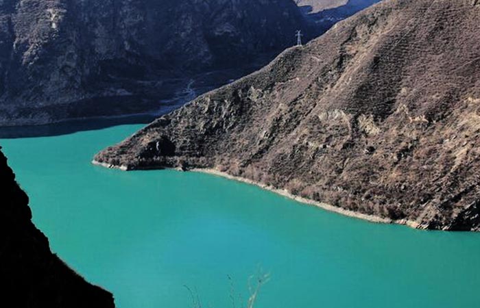
Location: Sichuan, China
Date: August 1933
Casualties: Over 3,000
The Diexi earthquake that occurred in 1993 in China induced a series of huge landslides along the Min River. Some of these landslides blocked the river and formed three large landslide lakes. One of the landslide dams which was located furthest downstream breached 45 days after the earthquake took place.
The area downstream was greatly affected by this sudden outburst of water from the dam and killed a whopping 3,000 people. One of the most serious and damaging disasters in China during the 20th century, the Diexi earthquake also damaged several other villages nearby.
Debris from the landslide led to the damming of local rivers. Diexi was completely submerged in water and today there is a huge landslide-made lake at the place where the town once proudly stood.
10. Khait Landslide
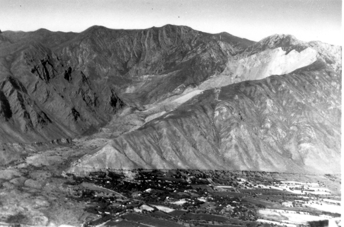
Location: Tajikstan
Date: July 1949
Casualties: 28,000
A 7.4 magnitude earthquake that occurred in 1949 in central Tajikistan triggered many hundreds of landslides in the mountains of Tien Shan. These earthquakes/ landslides shook the entire area and kept on intensifying day by day.
Between 7-9 July, these earthquakes became extreme and rocks and small landslides broke out across this region. At some places, entire mountains broke down and slid into the valleys, destroying hundreds of villages in one go.
Earthquake-triggered landslides are a major geological hazard in Central Asia and the Khait landslide was one of the most powerful earthquakes in the century of Tajikistan, with a force of 10.0 on the Richter scale. Because of this mass movement, a huge block of 250 million cubic meters fell off from Borgulchak Rock. While falling down, this block split in two parts and literally turned into a river of stones!
At such great speed, it destroyed everything that came in its way and in a matter of a few minutes, everything was finished. Khait had ceased to exist. A tangle of mountains of 40-60 meters in height was all that was left. As many as 28,000 people lost their lives due to this monstrous earthquake. However, the accuracy of this estimate is not known.
9. Kelud Lahars
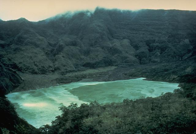
Location: East Java, Indonesia
Date: May 1919
Casualties: Over 5,000
The eruption that occurred in Indonesia in 1919 has been believed to be one of the deadliest tragedies of the 20th century. This eruption that occurred on Mount Kelud in East Java is said to have claimed the lives of an estimated 5,160 people. The volcanic eruptions and debris that flowed also killed several people.
This volcano that erupted 5,000 feet above sea level swept over the surrounding agricultural areas. Travelling as far as 25 miles, this hot mud and heated waters destroyed 40,000 acres of farm area and over 100 villages.
Although Kelud is a small volcano as compared to other volcanoes in Indonesia, but because it lies at the lake summit and the frequency of its eruptions, it has been the source of many deadly eruptions here.
8. North India Flood/Mudslides
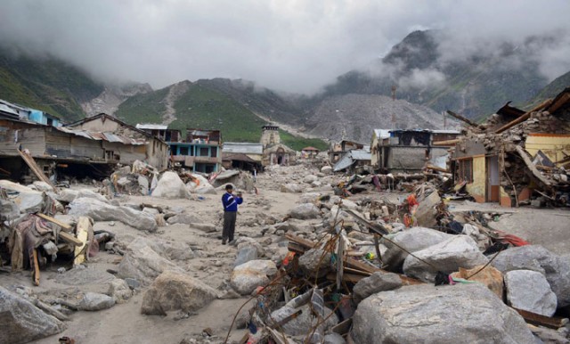
Location: Kedarnath, India
Date: June 2013
Casualties: 5,700
Kedarnath is a Hindu shrine in India that was devastated in June 2013 due to incessant rainfall that led to flash floods and landslides. This tragedy claimed the lives of over 5,000 people in the Indian state Uttarakhand. However, what actually happened that day has been a subject of speculation due to lack of eye witnesses and monitoring systems.
Several landslides were triggered due to extreme rainfall in June 2013 which caused widespread damage and loss of life in Alaknanda and Bhagirathi river valleys, with Kedarnath town bearing the heavy brunt of the massive disaster.
Study has revealed that there were two distinct events separated by a time gap of 10–12 hours. The first event was triggered by series of landslides, river blockades, breaching, flooding and river bank failures. The second event was mainly associated with Chorabari Tal Lake outburst flooding along with associated landslides and bank erosion.
7. Shizuoka Landslides
Date: 1958
Location: Shizuoka, Japan
Deaths: 1,094
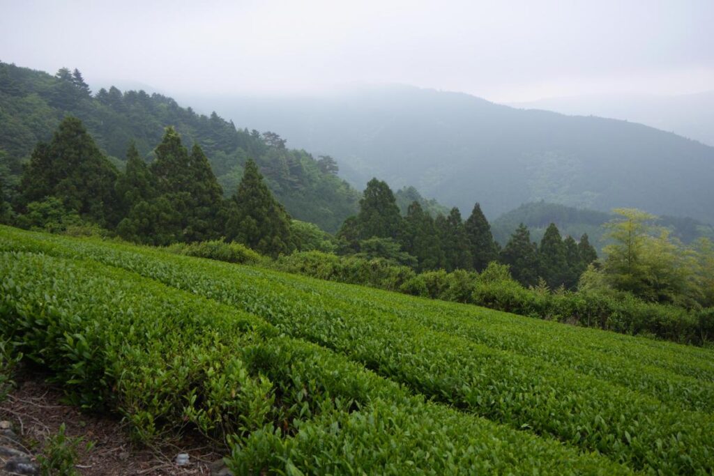
Great quality of Japanese green tea is procured from the Shizuoka Prefecture and almost 45% of tea is produced here. Tea plants are usually grown here in hilly terrain and because of this topography and other geological conditions, these tea fields are very prone to landslides.
Many major rivers originate in these mountain ranges and flow down to the Pacific Ocean and because of the steep river bed slopes, they discharge huge volumes of sediment in the downstream areas after heavy rainfall. This causes many sediment-related disasters in the area.
These natural disasters have left 500,000 refugees homeless and claimed the lives of 1,000 people. As many as 20,000 homes have also been destroyed by these floods and landslides.
6. Gansu Landslide
Location: Gansu, China (especially city of Zhouqu)
Date: August 8, 2010
Casualties: Over 1,500
Around midnight on August 8, 2010, a violent surge of loosened earth roared down mountain slopes and slammed into quietly sleeping neighborhoods in Zhouqu County in Gansu, China.
The catastrophic mudslides—the deadliest in decades according to state media—buried some areas under as much as 23 feet (7 meters) of suffocating sludge. 1,765 people died. Property damages totaled an estimated $759 million. More than 10,000 soldiers and rescuers combed through the mountains of mud that buried several parts of Zhouqu County.
5. Armero Tragedy
Location: Armero, Colombia
Date: November 13, 1985
Casualties: 23,000
In 1985, a horrific incident in Armero claimed the lives of as many as 25,000 people. In one of South America’s deadliest volcano eruptions ever, it is believed that the authorities had already been warned of an imminent eruption and the impact it would cause, but they failed to act.
In December 1984, three significant earthquakes took place which caused an increased volcanic activity. Even though the first eruption occurred in November, the authorities did not begin the task of evacuation as the activities soon returned to normalcy.
That same evening another earthquake occurred and this is when the lahars started racing down the mountain. 16% of Nevado del Ruiz’s surface ice was melted, releasing 43 million tonnes of water. Mixed with ash, rocks and trees, this lava started its journey towards the east.
A storm that evening knocked out communications, and residents were not warned of the approaching lahars until 11 pm. The lahars reached the town at 11.30, burying it under 5m of thick mud that was travelling at 8 metres per second.
These rivers raged through the town for the next two hours, by which time 85% of the town was buried. Over 20,000 of Armero’s 29,000 inhabitants died, but not all of them immediately.
4. Vargas Tragedy
Location: Vargas, Venezuela
Date: December 15, 1999
Casualties: 30,000
The landslide that occurred in December 1999 at the Vargas coast in Venezuela spewed devastation in the region. As many as 30,000 people lost their lives due to this monstrous disaster.
A storm worth a year poured down rain in Sierra de Avila mountains which triggered floods and caused one of the most massive landslides known in history. Because of these floods and landslides, over 8,000 homes were smashed and 700 homes were destroyed. All roads, power and telephone lines, sewage systems, which totaled to a whopping $1.79 million, were destroyed.
In 2011, three Venezuelan films were released that showcased the horrific landslides that destroyed the country back in 1999.
3. Sierra Leone Mudslides
Location: Freetown/Regent, Sierra Leone
Date: August 14, 2017
Casulaties: 1,141
In the early hours of 14th August 2017, torrential rains caused parts of Mount Sugar Loaf, a range of hills surrounding Freetown, to slide into the Regent Village vicinity. This led to heavy loss of life and property at the epicenter and downstream at Juba, Lumley, Kaningo/Kamayama axis.
While nobody knows how many people lost their lives due to this mudslide, a World Bank Report, which was released a month later, revealed 1,141 dead or missing. However, even more than a year after this mudslide, bodies were still being recovered from under the rubble and debris.
One of the worst disasters in the history of Sierra Leone, these floods destroyed as many as 1,245 properties with over 300 houses. As per ONS information, as many as 11,816 people had to be displaced, of which 7,000 were provided shelters in temporary camps in Freetown.
2. Yungay Landslide

Location: Yungay, Peru
Date: May 31, 1970
Casualties: 25,000
When the northern wall of Mount Huascaran was destabilized, it resulted in a rock, ice and snow avalanche which eventually buried the Yungay and Ranrahirca towns of Peru. This landslide of glacial ice and debris measured 2,990 feet wide and 1 mile long.
At a speed of 280-335 km/hr, this landslide advanced about 18 kilometres into the town. On its way, this landslide picked up even more deposits from glaciers and by the time it reached Yungay, it was carrying an estimated 80 million metre cubics of water, rocks and mud.
It is estimated that over 25,000 people lost their lives due to this landslide.
1. Haiyuan Earthquake/Landslides
Location: Haiyuan, China
Date: December 16, 1920
Casualties: More than 200,000
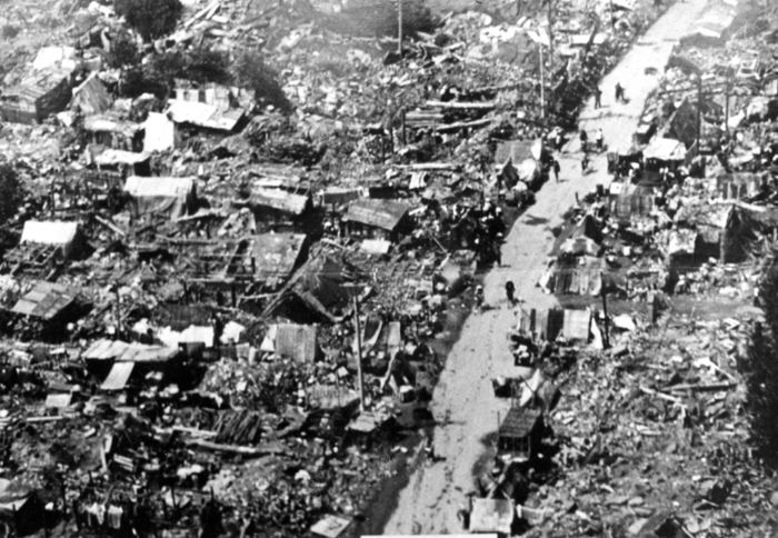
One of the worst landslides/earthquakes ever recorded in history has been the Haiyuan earthquake. This massive earthquake took place in 1920 with a magnitude of 8.5 in Haiyuan county. Several thousand landslides were triggered due to this landslide and thousands of people lost their lives.
According to several surveys that took place, this earthquake resulted in the blockage of many rivers and it is believed that the landslides triggered by this earthquake occurred on concave slopes.
Although it is not clear exactly how many people lost their lives due to this earthquake, it is assumed that as many as 200,000 people died.


