Nature
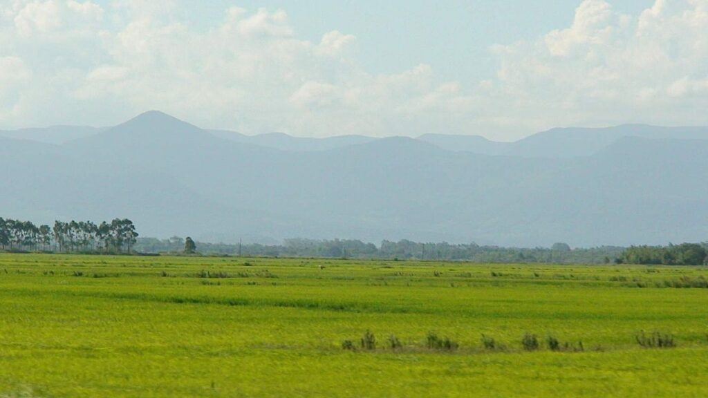
10 Biggest Grasslands In The World
Before classifying grasslands on the basis of their size, it is important to know what grasslands actually are. According to the United Nations Educational, Scientific and Cultural Organisation (UNESCO), grasslands have been described as less than 10 percent of the land which is covered with herbaceous plants and shrub cover. However, for wooded grasslands, this percentage increases to 10-40 percent.
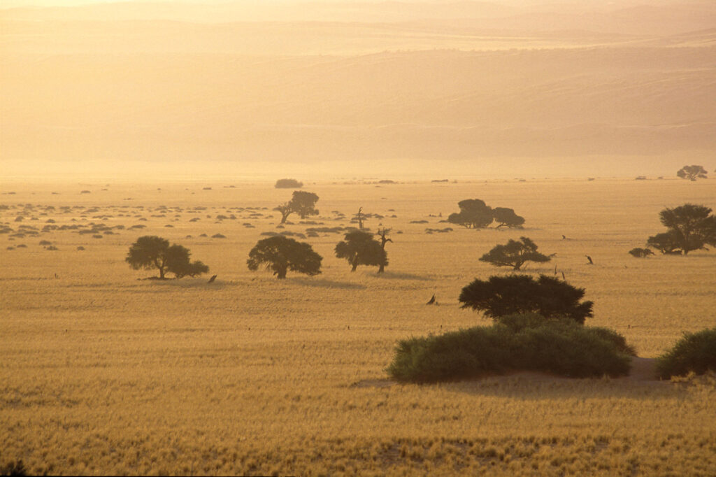
These grasslands are found where there is not enough rainfall for a forest to be able to survive or grow, but not so little either that a desert forms. Except for Antarctica, grasslands are found on every continent. However, even in the Arctic, due to extreme weather conditions, no grasslands are found.
There are so many names that grasslands go by. They are called prairies in the United States Midwest, pampas in south America, steppes in central Eurasia and the savannas in Africa. However, all of these grasslands have grass and vegetation in common.
Did You Know?
Grasslands account for between 20 and 40 percent of the world’s land area. Considering their importance, let us have a look at the 10 biggest grasslands in the world.
10. Hulun Buir Grassland
Region: Inner Mongolia
Size: 100,000 square kilometre
The Hulun Buir Grassland has been named after the Hulun Lake and Buir Lake. This grassland is located in the west of the Great Khingan Mountain. Currently, this grassland is one of the best preserved grassland of China as it has abundant grass.
Besides being home to alkali grass, esparto, alfalfa and wheatgrass, the grassland has more than 120 kinds of nutritious forage grass, and because of this reason, this grassland is rightly called the ‘grass kingdom.’ Hulun in Mongolian means ‘otter,’ and Buir means ‘male otter,’ and since these two lakes were in the past rich in otter, the grassland has been named thus.
The Hulun Buir Grassland is one of the world’s most famous prairie, and this vast area boasts beautiful scenery, more than 3,000 crisscrossed rivers, over 500 lakes dotted around, which constitutes a beautiful picture scroll, extends to the Great Hingan Mountains.
Did You Know?
Stretching across 100,000 square metres, the grass from here is even exported to Japan and other countries!
9. Great Hungarian Plain
Region: Hungary
Size: 100,000 square kilometre
The Hungarian Plain goes by several names. Some of them are Hungarian Nagy-Alföld, Nagy Magyar Alföld, or Alföld, English Great Hungarian Plain. This grassland also extends into eastern Croatia, northern Serbia and western Romania.
Cereals, fodder crops, livestock, vegetables, and fruit are widely raised on this plain. For more than 2,000 years, the Great Hungarian Plain has been home to a rich cultural tradition of pastoral living and animal husbandry techniques.
Did you Know?
With an area of about a 100,000 square kilometres, the grassland covers almost 56% of Hungary.
8. Manchurian Plain
Region: Northeast China
Size: 350,000 square kilometre
The Manchurian Plain is the heart of central lowland of northeastern China. It has a surface area of about 350,000 square km, all of which lies below 1,000 feet (300 metres) above sea level.
This plain is mostly a product that resulted due to erosion from the surrounding highlands. It is very undulating and has fertile black soils. The Manchurian Plain has the border of Da Hinggan Range on the west, Xiao Hinggan Range on its north. On the east side there are the Changbai ranges and on the south, it is open to the Gulf of Liaodong.
The Northeast Plain is China’s major soybean-growing area, and it also produces corn (maize), rice, wheat, sorghum, sugar beets, and flax. It is also an important base of heavy industry with an extensive system of railways, and it is rich in natural resources (iron ore, coal, and oil).
Did You Know?
Manchuria is made up of China’s three northeasternmost provinces: Liaoning, Jilin, and Heilongjiang.
7. Llanos Grasslands
Region: Venezuela
Size: 570,000 square kilometre
Also known as the Orinoco river plains, the llanos of Columbia and Venezuela are the northernmost section of the central lowlands of South America. The llanos have been formed by a large geologic depression that once was an arm of the sea.
Most of the Llanos is treeless savanna that is covered with swamp grasses and sedges in the low-lying areas and with long-stemmed and carpet grasses in the drier areas. Most mammals nest in the gallery forests and feed on the grassland. Among these include several species of deer and rabbit, as well as the anteater, armadillo, tapir, jaguar, and capybara, which is the world’s largest living rodent.
Did You Know?
Many native Americans flew to the Ilanos after the Spanish conquest of the coastal regions of south America. Soon enough, a mixed culture started to emerge that included Sapnish and African traditions. This particular economy depended on horses and cattle.
6. Pampas of Argentina, Brazil and Uruguay
Region: Argentina, Brazil and Uruguay
Size: 1,200,000 square kilometre
The Pampas are vast plains extending westward across central Argentina from the Atlantic coast to the Andean foothills, bounded by the Gran Chaco (north) and Patagonia (south). These grasslands get their name from a Quechua, which means a flat surface.
There are two district zones that the Argentine Pampas have been classified into. They are the dry zones and the humid zones. The dry zone in the west part includes mostly the province of La Pampa, which is mostly barren with great saline areas, brackish streams and sandy deserts.
The humid zone in the east is temperate and well watered and is considered the heart of the nation and is the country’s most populated area.
The animals that are found in the Pampas include foxes, skunks, small herds of guanaco, viscachas, bush dogs, and many bird species related to the sparrows, hawks, and waterfowl.
Did You Know?
Since the late 20th century some parts of the Pampas have become noted grape-growing regions, particularly the region around Mendoza, which produces more than half the wines of South America!
5. Kazakh Steppe
Region: Kazakhstan, Russia
Size: 804,450 square kilometre
The steppe grasslands of Eurasia were once among the most extensive in the world, stretching from eastern Romania, Moldova and Ukraine in eastern Europe (often referred to as the Pontic steppe) east through Kazakhstan and western Russia.
Also known as the Kirghiz steppe, these grasslands are one of the largest dry steppe regions on the planet. They cover approximately 804,500 square kilometres and extend to more than 2,200 kilometres from Caspian Sea to Altai Mountains.
The climate in the Kazakh Steppe is hot and witnesses dry summers. Sometimes, there are high winds due to which the area experiences drought in summers and snowstorms in winters.
Did You Know?
The Pontic and Kazakh steppes are together referred as Pontian steppe and they comprise 24% of temperate grasslands in the entire world.
4. Australian Savanna
Region: Australia
Size: 1,769,160 square kilometre
These grasslands in Australia stretch across northern Australia from Broome to Townsville. There are many types of biotic factors in an Australian tropical savanna. The short-beaked echidna is one of the examples of this biotic factor. This mammal is considered very popular in these grasslands.
In savannas, the soil is considered to be porous, which means it has rapid drainage of water. Also, the soil only has a thin layer of humus, which is the organic portion of the soil that is created by the decomposition of plant and animal matter.
In the Australian savanna, they have something called a wet season. This season lasts from December to March. Since the wet season has a lot of rain, it is blown from the equator to the north which causes major flooding in local areas.
Did You Know?
The average temperature in these grasslands is the low is -20 degrees celsius and the high is 30 degrees celsius. The amount of precipitation that this savanna receives is at least 30 inches and can receive as much as 50 inches.
3. Canadian Prairies
Region: Western Canada
Size: 1,780,650.6 square kilometre
A region in western Canada, the Canadian Prairies include the Canadian portion of the Great Plains and the Prairie provinces. These provinces are Alberta, Saskatchewan, and Manitoba. The total population of this region comes down to a large sum of 5,886,906 people.
The region is in a temperate grassland biome, which sustains the most wheat grown in Canada. The summers here are very hot and the average temperature is around 20 degree Celcius, and the winters are the opposite cold and low with a mean of -20*C (Winnipeg). The annual precipitation in the prairie regions vary from 250 mm – 700 mm. The climate in the prairies is perfect for wheat crops.
Did You Know?
Because of its mammoth size, this grassland has been listed third and has been included in the biggest grasslands in the world.
2. Great Plains of North America
Region: United States
Size: 2,900,000 square kilometre
The Great Plains are a massive high plateau that classify in the semiarid grasslands. The altitude of these grasslands at the base of the Rockies in the United States is between 5,000-6,000 feet above sea level.
The soil in this region is correlated with rainfall and grass cover. In humid regions, the grass is tall and has a heavy cover, the soil is deep and black. In areas with less moisture levels, the soil is lighter and has very less organic matter.
Talking about the natural vegetation here, there is mainly tallgrass and medium grass prairie in the east and in the west, there is short and bunch grass steppes. In the marginal areas, there are forbs and larger plants like the prickly pear cactus and yucca.
Did You Know?
With theirs huge size of 2,900,000 square kilometre, the Great Plains cover one-third of the United States!
1. Nagqu Grassland
Region: Tibet
Size: 40 million square kilometre
Lying in the northern part of Southwest China’s Tibet autonomous region, the Nagqu Prefecture neighbors Chamdo in the east, Ngari in the west, Lhasa, Nyingchi, and Xigaze in the south, and Xinjiang Uygur autonomous region and Qinghai province in the north.
With Tibetans making the majority, the grassland has a population of over 70,000 people. This grassland even has power over 10 counties and the Shuanghu Special Administrative Zone.
There are high mountains surrounding the river valleys in the east, which is the farming region of northern Tibet. Also referred to as Changtang, Nagqu falls within the sub-frigid zone and experiences extreme cold, a scarcity of oxygen, dry air, and storms.
The annual growing season lasts for 100 days, and during this period the area receives 80 percent of its annual precipitation. At this time the grasslands are emerald and grazed by flocks of sheep.
Did You Know?
Because of the infertile soil, the grassland is usually avoided by the farmers. As a result of this, the nomads frequent it as their livelihood depends upon the animals.